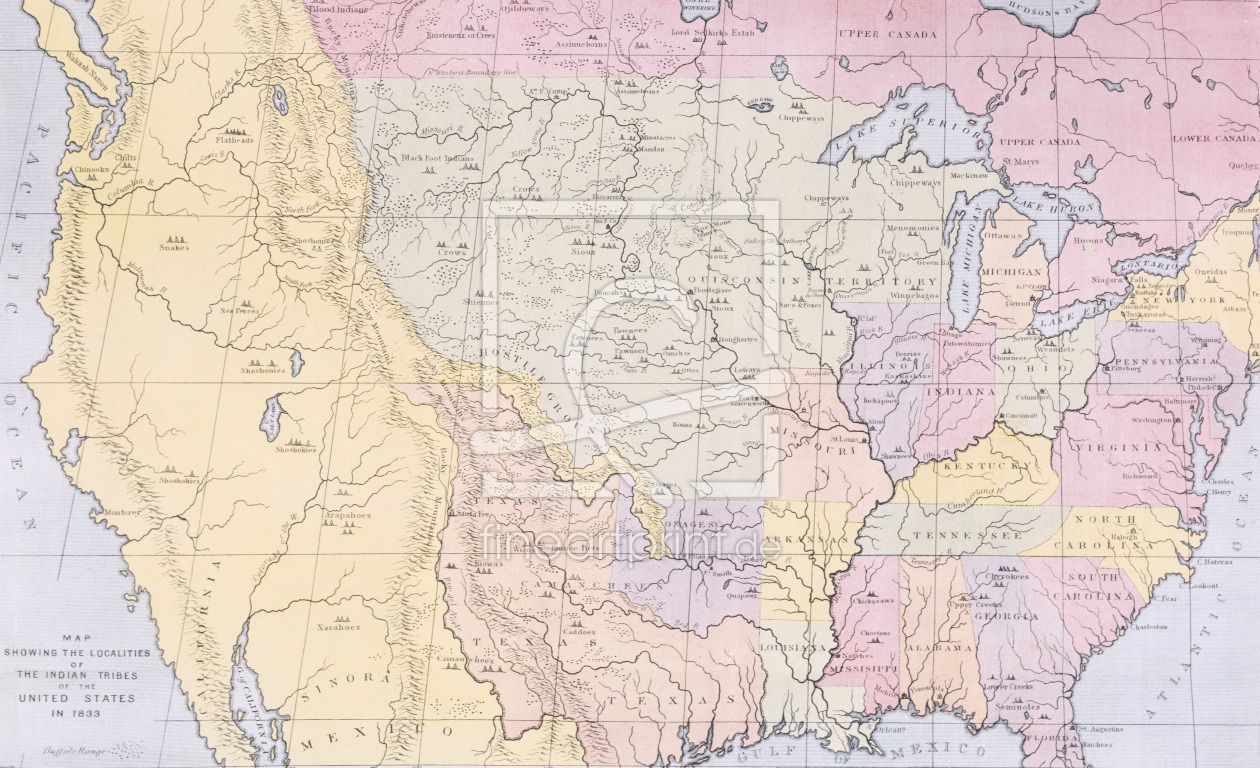
Map showing the localities of the Indian tribes of the US in 1833, illustration
Bild-Nr.: 31001710
von Catlin, George
5900 x 3596 Pixel
Normalversand: Versandfertig in ca. 5 Tagen nach Zahlungseingang.
Expressversand: verkürzt den Produktionszeitraum um bis zu 3 Arbeitstage, durch
- umgehenden Druck nach Zahlungseingang
- bevorzugte Bearbeitung in der Produktion
- beschleunigte Überstellung an die Versandlogistik
- Zustellung erfolgt in der Regel innerhalb von 24 Stunden, nach Erhalt der Versandbestätigung
Für besonders eilige Bestellungen, Expressversand für nur einmalig 9,90 € auf der Kassenseite aktivierbar.
Unser Standard Logistikunternehmen, mit DPD versenden wir alle Artikel bis maximal 120 cm x 80 cm.
Übergrößen und Artikel ab 120 cm x 80 cm, versenden wir mit TNT.
Auf Kundenwunsch, kann hier auch Samstags angeliefert werden.
Wenden Sie sich bitte hierfür an das ServiceTeam unserer kostenlosen Hotline.
Map showing the localities of the Indian tribes of the US in 1833, illustration
von Catlin, George
Breite: 5900 Pixel
Höhe: 3596 Pixel
Megapixel: 21.22 MP


